-
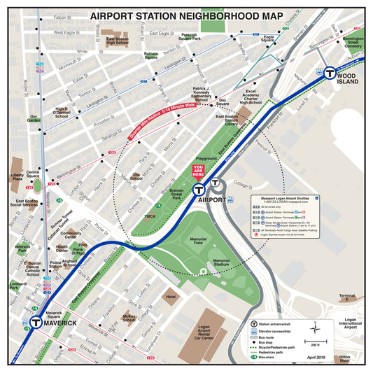
MBTA Airport Station Neighborhood Map (April 2018)
Regular price From $14.95Regular priceUnit price per -
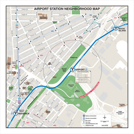
MBTA Airport Station Neighborhood Map (Jun. 2012)
Regular price From $14.95Regular priceUnit price per -
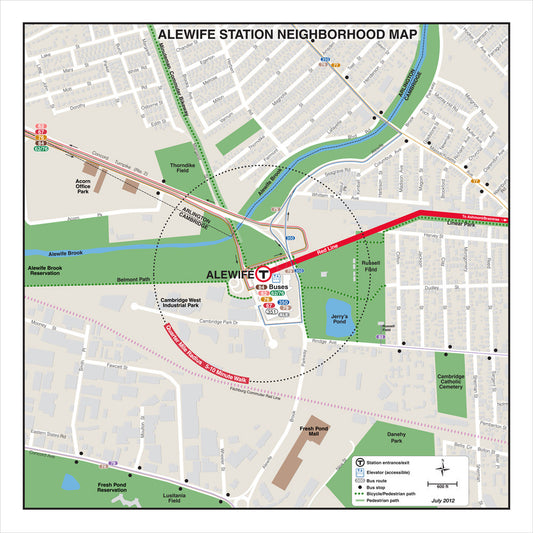
MBTA Alewife Station Neighborhood Map (Jul. 2012)
Regular price From $14.95Regular priceUnit price per -
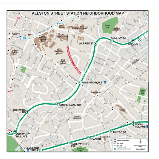
MBTA Allston Street Station Neighborhood Map (Aug. 2012)
Regular price From $14.95Regular priceUnit price per -
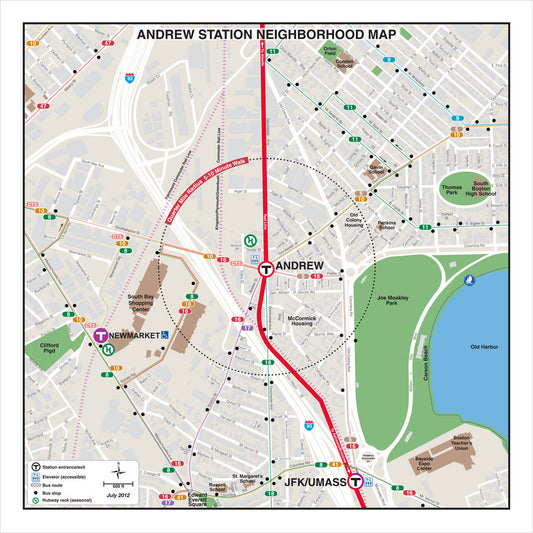
MBTA Andrew Station Neighborhood Map (Jul. 2012)
Regular price From $14.95Regular priceUnit price per -
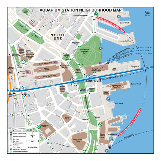
MBTA Aquarium Station Neighborhood Map (Oct. 2011)
Regular price From $14.95Regular priceUnit price per -
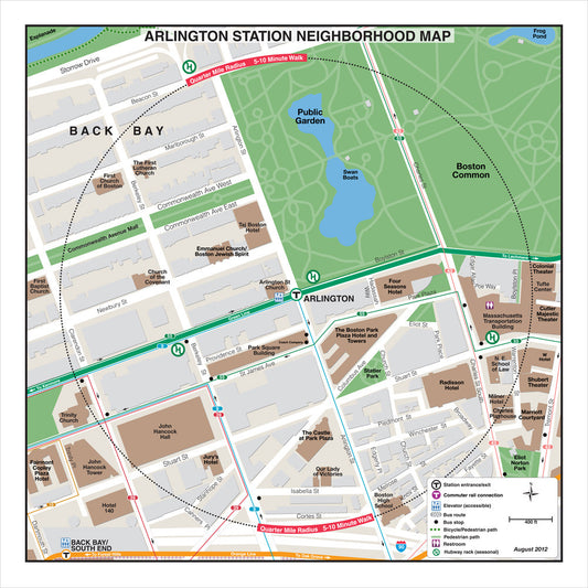
MBTA Arlington Station Neighborhood Map (Aug. 2012)
Regular price From $14.95Regular priceUnit price per -
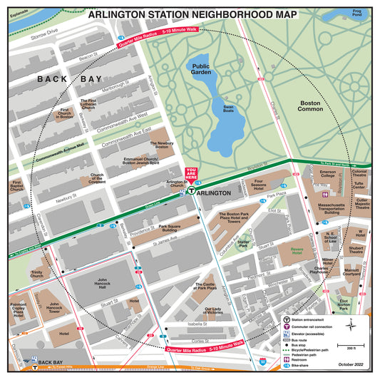
MBTA Arlington Station Neighborhood Map (October 2022)
Regular price From $14.95Regular priceUnit price per -
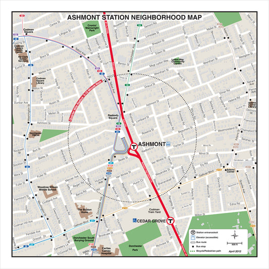
MBTA Ashmont Station Neighborhood Map (Apr. 2012)
Regular price From $14.95Regular priceUnit price per -
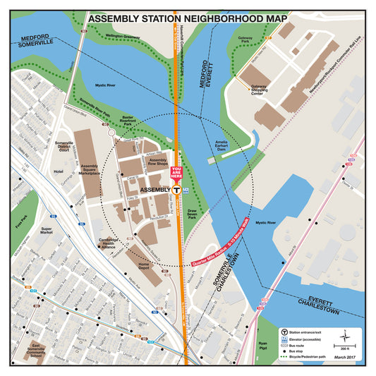
MBTA Assembly Station Neighborhood Map (March 2017)
Regular price From $14.95Regular priceUnit price per -
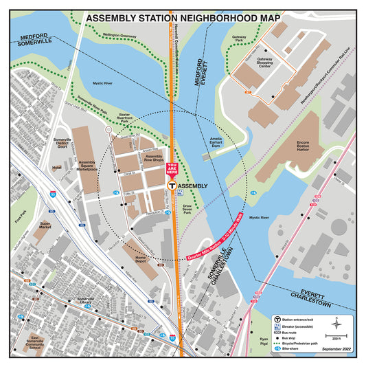
MBTA Assembly Station Neighborhood Map (Sept. 2022)
Regular price From $14.95Regular priceUnit price per -
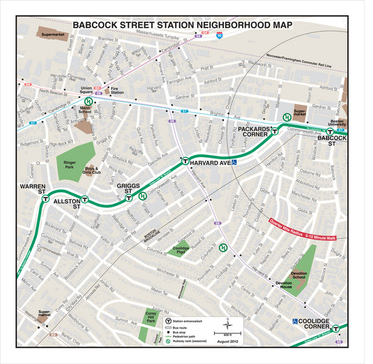
MBTA Babcock Street Station Neighborhood Map (Aug. 2012)
Regular price From $14.95Regular priceUnit price per -
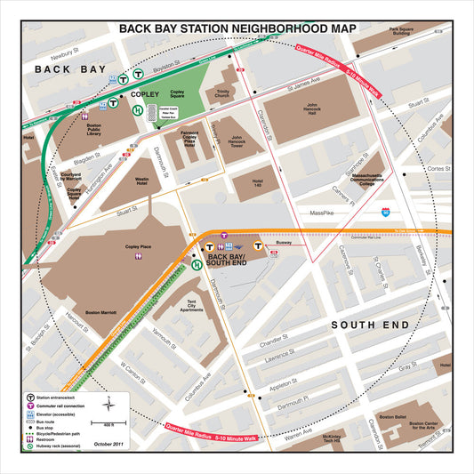
MBTA Back Bay Station Neighborhood Map (Oct. 2011)
Regular price From $14.95Regular priceUnit price per -
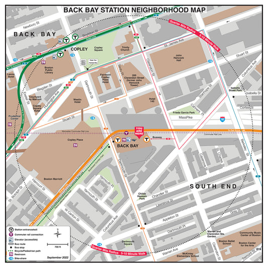
MBTA Back Bay Station Neighborhood Map (Sept. 2022)
Regular price From $14.95Regular priceUnit price per -
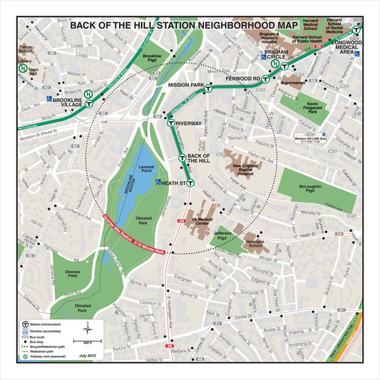
MBTA Back of the Hill Station Neighborhood Map (Jul. 2012)
Regular price From $14.95Regular priceUnit price per -
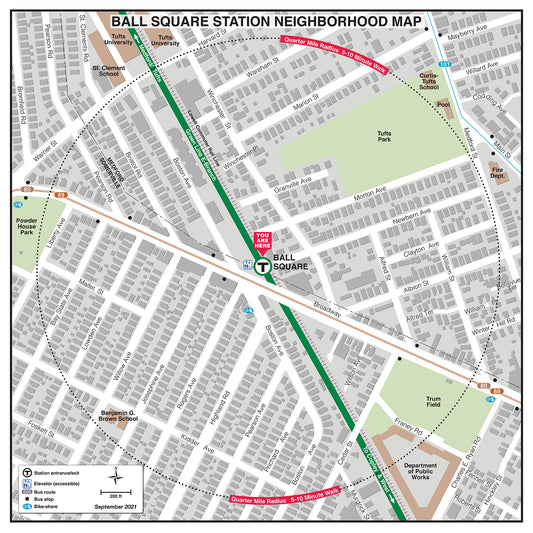
MBTA Ball Square Station Neighborhood Map (September 2021)
Regular price From $14.95Regular priceUnit price per -
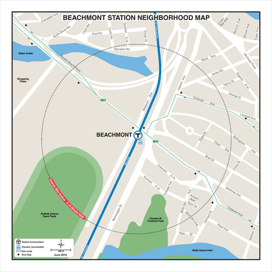
MBTA Beachmont Station Neighborhood Map (Jun. 2012)
Regular price From $14.95Regular priceUnit price per -
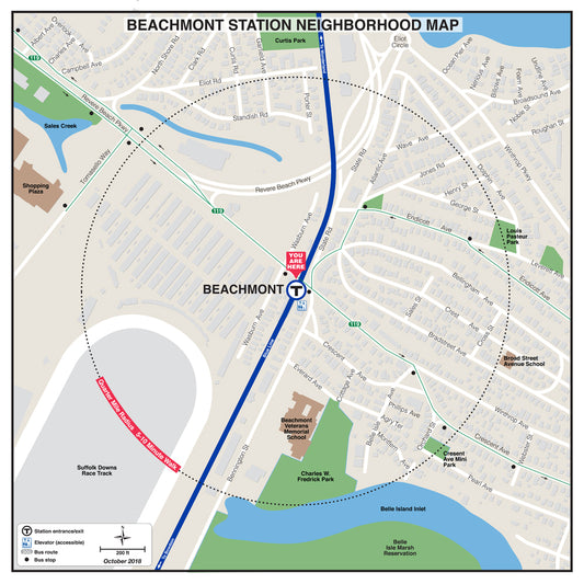
MBTA Beachmont Station Neighborhood Map (October 2018)
Regular price From $14.95Regular priceUnit price per -
MBTA Beaconsfield Station Neighborhood Map (Apr. 2012)
Regular price From $14.95Regular priceUnit price per -
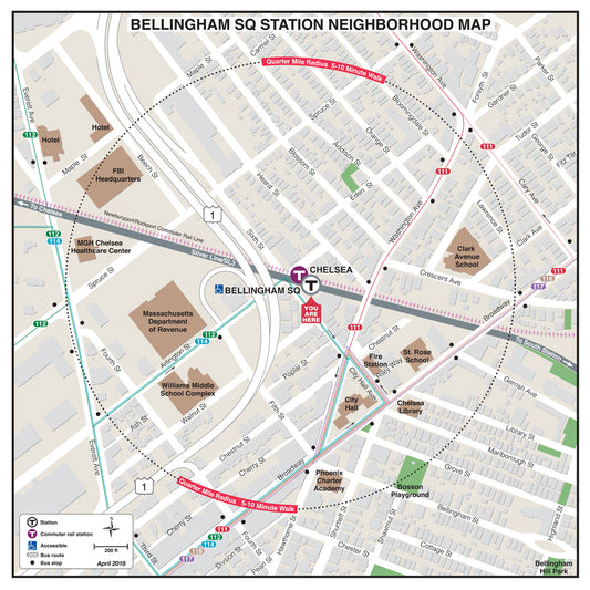
MBTA Bellingham Square Neighborhood Map (April 2018)
Regular price From $14.95Regular priceUnit price per -
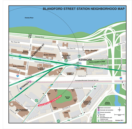
MBTA Blandford Street Station Neighborhood Map (Oct. 2011)
Regular price From $14.95Regular priceUnit price per -
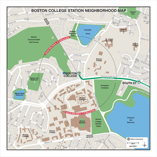
MBTA Boston College Station Neighborhood Map (Apr. 2012)
Regular price From $14.95Regular priceUnit price per -
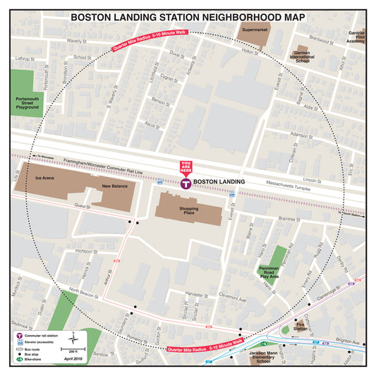
MBTA Boston Landing Neighborhood Map (April 2018)
Regular price From $14.95Regular priceUnit price per -
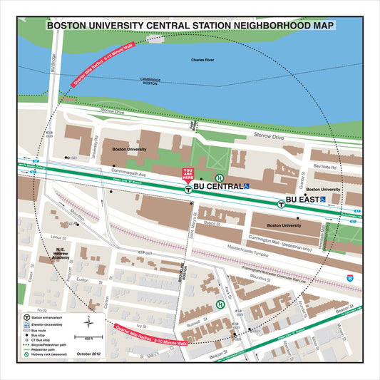
MBTA Boston University Central Neighborhood Map (Oct. 2012)
Regular price From $14.95Regular priceUnit price per